Sharm El-Sheikh, Egypt
Sharm El-Sheikh, Egypt
Docked at Sharm El-Sheikh Port
Latitude 27.86 Degrees North and
Longitude 34.29 Degrees East
April 19th, 2018
Weather: Very Sunny With Light Breeze and High of 84 Degrees With Low Humidity
Author: Don

Today we docked at Sharm El-Sheikh's “International Harbor”, which is really just a concrete dock with a big parking lot and high security. Sharm El-Sheikh is on the southern-most tip of the Sinai Peninsula of Egypt. According to legend, in the mountains two-hours driving time inland, the Bible-related events involving Moses and the ten commandments occurred. Saint Catherine's Monastery is there in honor of the holy site.
Sharm, as the locals call it, is a beach resort town with perpetual sunshine, plenty of sand, and the clearest blue ocean water we've seen during our entire world cruise. We luckily arrived after the European winter high tourist season here, so the town seemed somewhat quiet and relatively deserted.
Today, we joined a close by Red Sea snorkeling adventure. The weather was perfect, our boat and guides were fabulous, and the snorkeling conditions were superb! The water was comfortably cool and refreshing. After two consecutive days of blisteringly hot hiking and long bus rides, it was wonderful.
-
 Brightly Colored Clam and CoralBrightly Colored Clam and Coral
 -
 Butterfly FishButterfly Fish
 -
 Colorful Coral And ClamsColorful Coral And Clams
 -
 Coral, Clams And Trigger FishCoral, Clams And Trigger Fish
 -
 Debbie In The Red SeaDebbie In The Red Sea
 -
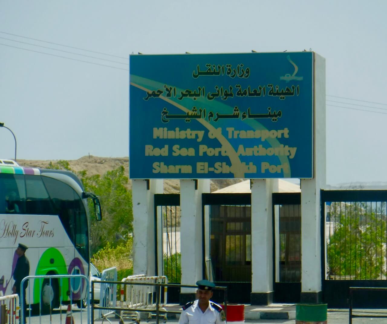 Entrance To Port FacilityEntrance To Port Facility
 -
 Fake Palm TreesFake Palm Trees
 -
 Fun Way To Spend A Day In Egypt. (Off Shore From Sultan Of Oman's Mansion)Fun Way To Spend A Day In Egypt. (Off Shore From Sultan Of Oman's Mansion)
 -
 Happy SnorkelersHappy Snorkelers
 -
 I Liked This SignI Liked This Sign
 -
 Orangespine Ubnicorn Fish With Parrot FishOrangespine Ubnicorn Fish With Parrot Fish
 -
 Our First Red Sea Snorkeling SpotOur First Red Sea Snorkeling Spot
 -
 Our Second Snorkeling StopOur Second Snorkeling Stop
 -
 Panther Torpedo Ray On Ocean FloorPanther Torpedo Ray On Ocean Floor
 -
 Para-Sailer (With Jordan Across Aqaba Gulf Behind)Para-Sailer (With Jordan Across Aqaba Gulf Behind)
 -
 Red Sea Coral ReefRed Sea Coral Reef
 -
 Reef Wall With Healthy CoralReef Wall With Healthy Coral
 -
 School Of Arabian Cleaner Wrasse In Deeper WaterSchool Of Arabian Cleaner Wrasse In Deeper Water
 -
 Seargent Fish And CoralSeargent Fish And Coral
 -
 Seargent FishSeargent Fish
 -
 Top Of Shallow ReefTop Of Shallow Reef
 -
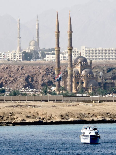
 Two Dramatic Mosques In Sharm El-SheikhTwo Dramatic Mosques In Sharm El-Sheikh
Comments 4
Looks like a nice spot for a cool dip! I’m sure you were ready for it.
Thanks for following along with our journey! It will be great to be back home. See you both in about a week.
–Don
Almost home, will see you soon and hear all about your travels. We have enjoyed reading all of your blogs. It was a great geography lesson; just like being there.
Before the trip, I’m sure I couldn’t have described the relative positions of any of the countries in the Western Pacific or Southeast Asia, but I’m ready for the geography test now! Thanks for reading the travelogue, Gordon!
–Don